UT (City planning map area), Austin: homes for rent and public records
UT (City planning map area) is filed under City planning areas in our Austin neighborhood guides. This page brings current rental listings together with dated permits, licenses, crashes and 311 records within 800 m so you can compare a specific home before you choose your next address.
This profile follows an official City of Austin planning area. Planning boundaries may differ from everyday neighborhood names. Interior label point derived from the official City planning-map area geometry; not an entrance, address or property boundary. View the City’s boundary source ↗
Tell us your budget, timing and must-haves. A local agent can help verify rental availability, lease terms and recurring costs.
Loading map...
UT · City neighborhood-plan status: Non-neighborhood planning area. This describes the City’s planning document, not the neighborhood. The outline is the inventory search geography; reported property points may be approximate. Official boundary source ↗
THE PLACE. THE HOMES. THE POSSIBILITIES.
Find your next rental.
Current rental listings · UT · City planning map area · City neighborhood-plan status: Non-neighborhood planning area
1active rentals
Find the space for your next chapter.Confirm each listing’s rent period, deposits and recurring charges.
0 active under contract · 0 pending in this public feed
Uses the City’s UT planning boundary. Planning geographies can differ from everyday neighborhood names. City neighborhood-plan status: Non-neighborhood planning area. This is the status of the City’s planning document for the boundary, not a description of the neighborhood. View boundary source ↗
A few homes to picture yourself in.
Recently updated in the source · statuses shown on each home
MLS source updated Oct 2, 2026, 12:35 PM Central · Asking prices and availability can change.
MLS source, pricing method & coverage
Source updated Oct 2, 2026, 12:35 PM Central. Counts use eligible public listings matched to the labeled geography. Sale prices use positive asking prices on Active Residential listings; the median is shown with at least three priced listings. These are asking prices, not sold prices, valuations or all homes in the area. Rentals are counted separately; no rent period is assumed.
Under-contract and pending counts describe records currently in this feed. Location errors and omitted coordinates can affect boundary matches. The initial active-listing import is complete. Different areas can overlap; do not add their counts together.
Listing source and permitted use
Presented by Austin Local Team · All City Real Estate, ltd. Co. · (512) 710-0337
Listings courtesy of Unlock MLS as distributed by MLS GRID.
Some IDX listings have been excluded from this website. This search shows eligible Active listings, and eligible Active Under Contract and Pending listings when you include them. Availability can change; confirm current status with the listing agent.
IDX information is provided exclusively for consumers’ personal, noncommercial use and may not be used for any purpose other than to identify prospective properties consumers may be interested in purchasing. Data is deemed reliable but is not guaranteed by MLS GRID. Use may be subject to an end user license agreement prescribed by the applicable MLS. Any use or search other than by a consumer looking to purchase real estate is prohibited.
Based on information submitted to the MLS GRID as of Oct 2, 2026, 12:35 PM Central. All data is obtained from various sources and may not have been verified by broker or MLS GRID. Supplied Open House Information is subject to change without notice. All information should be independently reviewed and verified for accuracy. Properties may or may not be listed by the office/agent presenting the information.
Copyright notices
The Digital Millennium Copyright Act of 1998, 17 U.S.C. § 512 (the “DMCA”) provides recourse for copyright owners who believe that material appearing on the Internet infringes their rights under U.S. copyright law. If you believe in good faith that any content or material made available in connection with our website or services infringes your copyright, you (or your agent) may send us a notice requesting that the content or material be removed, or access to it blocked. Notices must be sent in writing by email to: austin@smartaustinrealty.com.
The DMCA requires that your notice of alleged copyright infringement include the following information: (1) description of the copyrighted work that is the subject of claimed infringement; (2) description of the alleged infringing content and information sufficient to permit us to locate the content; (3) contact information for you, including your address, telephone number and email address; (4) a statement by you that you have a good faith belief that the content in the manner complained of is not authorized by the copyright owner, or its agent, or by the operation of any law; (5) a statement by you, signed under penalty of perjury, that the information in the notification is accurate and that you have the authority to enforce the copyrights that are claimed to be infringed; and (6) a physical or electronic signature of the copyright owner or a person authorized to act on the copyright owner’s behalf. Failure to include all of the above information may result in the delay of the processing of your complaint.
FROM OUR AUSTIN RESEARCH NETWORK
University of Texas: start with the Blanton
The Blanton Museum of Art offers a public-facing way to explore the University of Texas area. Its collection, changing exhibitions and guided visits create several possible itineraries, while the museum’s own access rules help distinguish an art visit from a general campus walk.
Austin Texas Things editorial research · imported . Original source check dates appear below.
Explore different collection strengths
The Blanton describes holdings in American Western landscape painting and art of the Spanish Americas, among other areas. Its collection and exhibition information helps choose a focus before arriving. [4]
Let a tour shape the visit
The museum advertises gallery-teacher-led public tours in English and Spanish. Its calendar identifies the particular theme and date for each session. [2]
Check changing exhibitions by date
The exhibition page includes temporary shows with defined runs. A work or artist featured on an older event page may not be on view for your visit. [4]
Before you visit
Review the museum’s visitor guidelines
The Blanton provides rules for bags, photography, drawing materials and animals in its buildings. Read those guidelines before bringing equipment for a sketching or photography visit. [3]
Use the museum calendar for special closures
The visit page links current closures and ticket information. General university access or a campus event does not establish the museum’s operating schedule. [3]
A few local questions
Are there guided public visits at the Blanton?
The museum lists gallery-teacher-led public tours, including English and Spanish options. Check the current calendar for the tour that interests you. [2]
Does this mapped UT area represent an adopted neighborhood plan?
The saved city boundary snapshot classifies UT as a non-neighborhood planning area. Its inclusion provides a mapping unit rather than proof of an adopted neighborhood plan. [1]
Sources for this local guide
These are dated editorial notes. Check the original source for current access, schedules and project status.
What's changing around UT (City planning map area).
Counts from the research database behind Zabalist, measured within 0.5 mi (800 m) of the reference point. Each figure names its own window. Filings and reports are not a description of any home, block or resident, and they are never combined into a score.
Radius: within 800 m (0.5 mi) of the neighborhood's reference point (30.2859, -97.7328), which is a map marker and not a boundary. ZIP-scoped layers use inferred postal ZIP 78712, voted from mapped locations around the reference point. Rollup generated Oct 2, 2026.
Development and construction
Sources: Austin Building Permits (database sync Oct 1, 2026); Austin Site Plans (database sync Oct 1, 2026); TABS State Projects (database sync Oct 1, 2026); Zabalist unified projects (sync date not registered).
Construction permits issued
past 2 years1979 new residential buildings
Development projects with activity
past 12 months835 site plans · 0 subdivision cases on file
Site plan: the City of Austin’s development application for anything beyond a single house. It is a proposal, not an approval or completed construction.
TDLR project registrations
past 12 months41
TDLR project registration: a state filing required for commercial and public construction over a cost threshold. It means a project was submitted for accessibility review, not that it was built.
Licenses and inspections
Sources: TABC licenses and permits (database sync Aug 8, 2026); Austin Health Inspections (database sync Oct 1, 2026).
New venue alcohol licenses
past 12 months · inferred postal ZIP 7871203 active at sync · bars, restaurants and venuesCounted for the postal ZIP, not the radius.
TABC license types: state alcohol permits for bars, restaurants, stores, venues and events. A license record is not confirmation that a business is open.
Food establishments inspected
past 12 months16
Streets and code
Sources: Austin Traffic Crashes (database sync Oct 2, 2026); Austin 311 Service Requests (database sync Oct 2, 2026); Austin Code Complaints (database sync Oct 2, 2026).
Traffic crashes
past 3 years3530 fatal · 8 serious injury
311 service requests
past 12 months8498 open or in progress at sync
311 request: a service request logged with the City of Austin (missed pickup, street light, loose animal and similar). It records that something was reported, not that it was verified.
Code-compliance cases
past 12 months · inferred postal ZIP 7871200 active at syncCounted for the postal ZIP, not the radius.
Code-compliance case: a City investigation opened after a report of a possible ordinance violation. An opened case is not a confirmed violation.
197 construction permits issued within 0.5 mi in the past 2 years, including 9 new residential buildings.
83 development projects with activity within 0.5 mi in the past 12 months; 5 site plans and 0 subdivision cases on file.
353 traffic crashes recorded within 0.5 mi in the past 3 years; 8 with a serious injury, 1 involving a pedestrian, 4 involving a bicyclist.
849 311 service requests logged within 0.5 mi in the past 12 months; 8 still open, most often “Parking Violation Enforcement” (252).
16 food establishments inspected within 0.5 mi in the past 12 months.
Nearest development records
The 5 closest filings across permits, site plans, TDLR registrations, subdivisions and projects, by distance from the reference point. Verify the site before connecting a record to a home.
ART - Sculpture Studio & Grad Studio Renovation · 325 ftTDLR project registration · 2301 San Jacinto Blvd, Austin, TX 78705 · Interior renovation of existing studio spaces; existing rooms to be repurposed for new studios and grad spaces. Existing ceiling and lighting to be replaced for new ceilings and LED fixtures. Total project area is ~6300 SF. · estimated cost $882.1K · Inspection CompleteRegistered Apr 21, 2026
Sculpture Spray Booth,CAPITAL PROJECT NO. CP 919197 · 325 ftTDLR project registration · 2301 SAN JACINTO BLVD, Austin, TX 78705 · Installation of an owner furnished enclosed spray booth. The booth is 371 sqft, with an approximate project area of 600 sqft. · estimated cost $130K · Review CompleteRegistered Oct 25, 2025
The Precursors – We Are Texas East Mall Phase 1A · 404 ftTDLR project registration · 302 E. 23rd St., Austin, TX 78712 · Commemoration of Precursor group, water feature and landscape design to replace current defunct water feature and roundabout. · estimated cost $35M · Review CompleteRegistered Nov 5, 2025
The Precursors – We Are Texas East Mall Phase 1A · 404 ftDevelopment project · 302 E. 23rd St. · permitted · commercial · $35MLast activity Nov 5, 2025
Newest bar, restaurant and venue licenses
TABC licenses are counted for inferred postal ZIP 78712, not the radius (the ZIP is inferred from the reference point): 0 new in the past 12 months, 3 active; database sync Aug 8, 2026. A license is not proof a business is open.
Moody Center at University of Texas · 2001 Robert Dedman DrMixed beverage permit · late hoursIssued Mar 29, 2022
SODEXO AT DKR · 405 DELOSS DODDS WAYMixed beverage permit · food and beverage certificateIssued Sep 10, 2012
PREMIER HOSPITALITY INC. · 707 Clyde Littlefield DrMixed beverage permit · late hoursIssued Feb 11, 2003
Streets and service requests
353 crashes in the past 3 years (1 involving a pedestrian, 4 a bicyclist) and 849 311 requests in the past 12 months, excluding requests marked duplicate or cancelled, all within 0.5 mi (800 m) of the reference point.
Most frequent 311 request types
Parking Violation Enforcement252 requests
Traffic Signal - Maintenance89 requests
Shared Micromobility57 requests
Parking Sign Maintenance49 requests
Compost32 requests
Top 5 categories shown · 479 of 849 requests
Crashes by year
The first and last years cover only part of the year.
2023 (from Oct 3)30 crashes
2024127 crashes
2025120 crashes
2026 (to Oct 2)76 crashes
ELSEWHERE IN CITY PLANNING AREAS
Neighborhoods across City planning areas
UT (City planning map area) does not have a published City or Census outline of its own, so these are the neighborhoods grouped under City planning areas. Open one to see its own outline, records and homes.
These are grouped by part of the metro, not by a published outline, because this guide has none to test against. This is a browsing relationship. It does not establish shared HOA membership, legal boundaries or services, and county identities stay with each place. Listing counts were recorded on ; open a neighborhood for its current homes.
Keep UT (City planning map area) in your Austin notebook.
Save this area profile alongside your field guides, then compare specific addresses and your own search criteria. An area bookmark records your interest; it is not a property-search boundary.
Start with the available home and its actual lease terms. Confirm the advertised rent period, deposits, recurring fees, pet policies and move-in timing before comparing your total monthly cost.
Compare the property type, layout and condition against your must-haves.
Test your actual commute and visit the block at different times of day.
Review nearby development records and confirm current project status.
Verify school assignments directly with the district for the exact address.
Review the lease, maintenance responsibilities, insurance requirements and all mandatory fees with your agent.
What living in UT (City planning map area) looks like in the public record.
Flood, taxes, schools, change, ground, getting around and weather for the whole area, measured as shares of homes (911 address points, 320 sampled), with trends against the metro. Use the Layers button on the map above to see each one.
How much of the area floods?
6.6% of homes sit in FEMA’s 1% annual-chance floodplain.
Worth a look
City of Austin modeled floodplain (Atlas 14): 8.4% of homes.
0 NFIP claims paid in ZIP 78712 in the past 10 years (0 since 2009).
Each home’s flood status depends on its exact location; check the listing’s own page.
Are homes in a MUD?
No MUD or similar special district covers this area.
Nothing unusual
Special districts add their own property tax on top of county, city and school rates.
Which schools serve the area?
Austin ISD (100%)
Nothing unusual
Loading the map…
Use the zoom buttons, or Control plus scroll, to zoom. Use two fingers on touch screens. Markers can be selected with the keyboard. Mapped locations may be approximate.
Highlights the matching numbered marker on the map above.
Outline: the area. Numbered: campuses in or within about ½ mile of it, by level.
Austin ISD: district TEA 2024–25: C.
Campuses in or near the area are listed by level, not ranked. Attendance zones are not mapped; check each district’s locator for an address.
How fast is it changing?
0 new homes, apartments and ADUs permitted so far in this year.
Nothing unusual
Past 24 months: 1 site plans and 0 zoning cases inside the area.
15 active TxDOT projects cross the area.
How have home prices moved?
Price index not available for this ZIP.
Nothing unusual
FHFA’s repeat-sales index tracks the same homes over time; it is not a typical sale price and not MLS data. The latest year can be revised.
What is the ground like?
2.5% of homes are on highly expansive clay.
Nothing unusual
Soil survey coverage: 7.5% of homes.
Expansive clay is common in Austin; a foundation inspection is the check for any one home.
Getting around and getting outside
37 CapMetro stops inside the area, 33 with peak service every 15 minutes or better.
Nothing unusual
Planned light rail: 29th Street Station (phase 1), 370 ft outside the area.
Planned light rail: UT West Mall Station (phase 1), inside the area.
Planned light rail: 15th Street Station (phase 1), 0.3 mi outside the area.
Details & limits
Parks and preserves: 0 touching the area.
How hard is the weather on roofs?
About 1.75 hail days a year nearby (metro average 1.56).
Nothing unusual
This area
1.75 /yr
Metro average
1.56 /yr
Days with a NOAA Storm Prediction Center hail report within about 6 miles, 2006–2025. Reports trend with population; treat them as relative exposure.
Sources, dates and licences
USDA NRCS soil survey (SSURGO) · data as of 2025-09-05 · US Government public domain (USDA NRCS)
TCEQ Edwards Aquifer map · Texas state public data
FHFA House Price Index · data as of 2026-03-31 · FHFA public data; cite FHFA
FHFA House Price Index (metro) · data as of 2026-06-30 · FHFA public data; cite FHFA
FEMA National Flood Hazard Layer · data as of 2026-06-10 · US Government public domain (FEMA open data)
USGS PAD-US protected areas · data as of 2026-04-22 · Public domain (USGS); cite PAD-US.
NOAA Storm Prediction Center reports · data as of 2025-12-31 · Public domain (NOAA / NWS).
City of Austin floodplain model · data as of 2023-04-27 · City of Austin open data (public)
TEA campus locations · data as of 2026-09-24 · TEA public GIS open data; no explicit license on the ArcGIS item (attribute TEA)
TCEQ water district boundaries · data as of 2026-09-30 · TCEQ open data (data.texas.gov directory; public ArcGIS MapServer); no license stated. Public information of a Texas state agency.
CapMetro GTFS schedules · data as of 2026-08-26 · CapMetro developer data terms (capmetro.org/developer; Texas open-data portal license SEE_TERMS_OF_USE); attribute CapMetro
OpenFEMA NFIP claims by ZIP · data as of 2026-06-01 · OpenFEMA terms: free to use, attribute FEMA, no warranty; redacted records.
TEA school district boundaries · data as of 2026-04-30 · TEA public GIS open data; no explicit license on the ArcGIS item (attribute TEA)
TEA accountability ratings · data as of 2026-06-14 · TEA open data; no license stated. Public information of a Texas state agency.
Austin Transit Partnership light rail plan · data as of 2026-07-23 · ATP public GIS (ArcGIS); no explicit license on the item (attribute Austin Transit Partnership)
City development cases · Public records from city portals; attribute the city.
TxDOT Project Tracker · data as of 2026-09-30 · TxDOT Open Data portal; public, attribute TxDOT, no warranty
Texas Comptroller special-district tax rates · data as of 2026-01-28 · Comptroller published data; no license stated. Public information of a Texas state agency.
CAPCOG regional 911 address points · data as of 2026-09-01 · CAPCOG regional open data; cite CAPCOG.
Shares use 911 address points as a stand-in for homes; apartments count once per address. Not an appraisal, survey or school assignment.
Owners & renters nearby
About 8 in 10 households in and around UT (City planning map area) rent their home (higher than the Austin-area average of about 4 in 10). 1 home in UT (City planning map area) is listed for rent now.
Worth a look
Loading the map…
Use the zoom buttons, or Control plus scroll, to zoom. Use two fingers on touch screens. Markers can be selected with the keyboard. Mapped locations may be approximate.
Highlights the matching numbered marker on the map above.
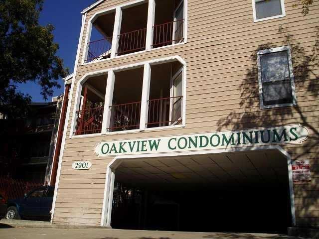 ActiveAvailable photo 1 / 18